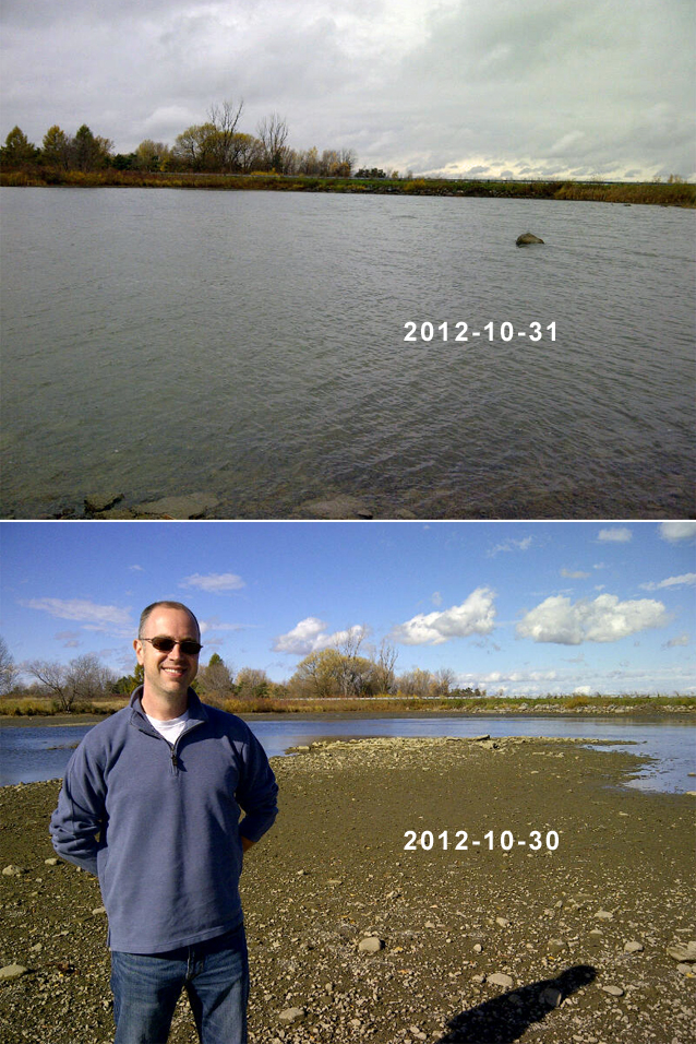
Top: A day later the water level is much closer to normal. Photos courtesy of Jim Brownell.
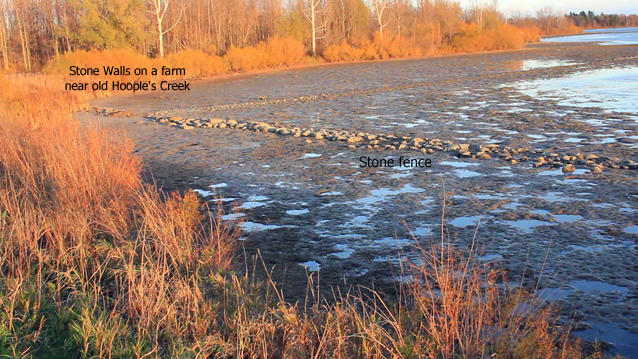
CFN – On Tuesday afternoon an intriguing social media post caught my eye. Jim Brownell put up a few photos he shot earlier in the day while trekking with a buddy. Presumably due to water levels in the lake being brought artificially low in anticipation of the high winds accompanying post-tropical storm Sandy, some long-submerged historical landmarks were once again above water. In fact, some areas were so dry that they could be travelled upon by foot.
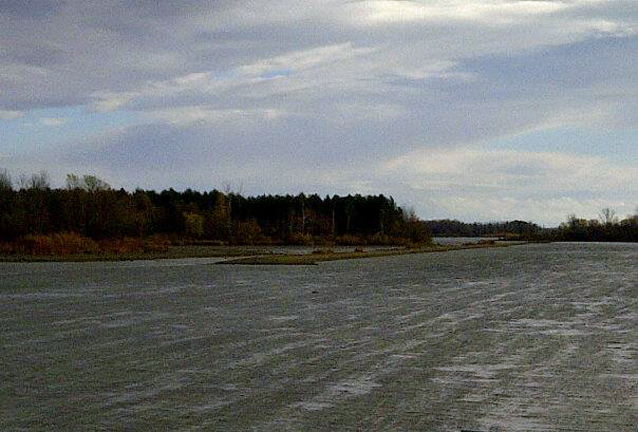
Grand Trunk/CN Railroad line. Photo courtesy of Jim Brownell.
 Knowing full well the high level of existing interest in the Lost Villages that resulted from man-made flooding of once rural lands to tame the mighty St. Lawrence River for navigation and for hydro electricity, I quickly forwarded one of Jim’s pics to South Stormont Mayor Bryan McGillis, jokingly suggesting that a great tourism opportunity was right on his doorstep. The mayor was quick to reply that he’d never seen the water level in Hooples Bay so low.
“I am sure the low water level is a flashback for many people in our community who were affected and displaced from the lost villages during the Seaway project. Many memories and stories remain in our hearts thanks to all the members of the Lost Villages Historical Society, and the many books that have been written over the years.” South Stormont Mayor Bryan McGillis
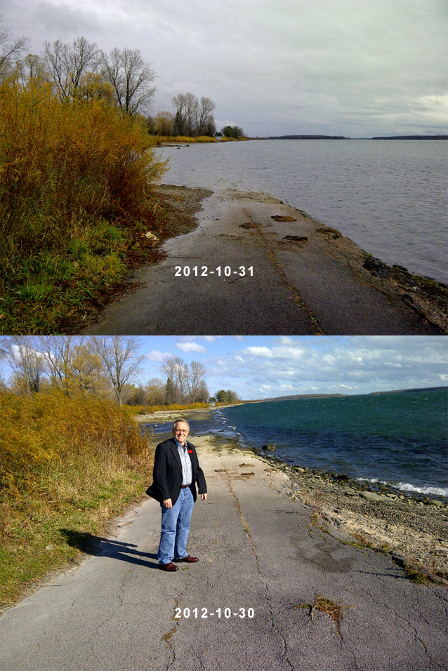
Top: A day later the water level was closer to normal with much less of the old highway visible.Photos courtesy of Jim Brownell.
That did it; I couldn’t resist the temptation any longer. Realizing that these opportunities do not present themselves very often and that the situation could quickly revert to normal, I grabbed cameras and tripod, and pointed the car west. The view at Hooples Bay, St. Lawrence Valley Cemetery, the Long Sault-Ingleside Causeway as well as at points along #2 highway was a shutterbug’s dream. Only the eventual setting of the sun was enough to send me back to Cornwall for a bite of supper and to continue the work temporarily put aside to take in the rare view.
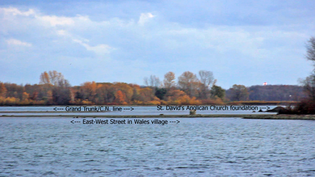
This photo was taken at the St. Lawrence Valley (Union) Cemetery. Photo: Don Smith
Back at my computer, sorting it all out, Jim Brownell proved to be a great ally in identifying some of these landmarks and in providing some reference photos for this scribbler’s article.
With the bright sky, above-average temperatures after the storm and brilliant autumn colours, it was much too nice an afternoon to be indoors.
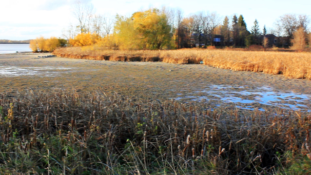
You can almost walk across Hoople Bay.”
South Stormont Mayor Bryan McGills Photo: Don Smith
Enjoy a two minute video clip of the area.
http://youtu.be/45m7GP-UB9s
If you, like me, have an interest in local history, and in the Lost Villages in particular, a visit or three to chat with the friendly and knowledgeable volunteers at the Lost Villages Museum is a short, and worthwhile journey to their complex on County Road 2 west of Cornwall. You can also visit them online by following this link.
Don Smith reports on a variety of topics, notably good news items as well as social justice issues.


I believe that they lowered the water level to let the Lost Villages Zombies out to walk on Halloween.
Reg, the water levels had returned to normal by that time 🙂
Very cool, seeing a bit of history. The Seaway website lists some water levels here. http://www.greatlakes-seaway.com/R2/jsp/R2.jsp?language=E&loc=EV00.jsp
I don’t know how to read the numbers, but look to be from a low of 35 to a high of 73 over those few days.
That must have been a thrilling experience. I would have loved to have been there. The stone fencel was the most touching for me.
Thanks for the link, Eric. The Iroquis sector is showing recent levels around 73m. There is also the hydro dam at Cornwall to consider in addition to the locks.
While on their site, did you notice that 11 jobs are posted, including three in Cornwall:
– bilingual Chief Information Security Officer (CISO)
– bilingual Corporate Telecommunications Specialist
– bilingual Financial Analyst
Also four in St. Catharines
– French is listed as asset for one of the four jobs
Hi Don:
Thanks for sharing this really amazing look at the evidence of life that once existed where the water now flows. I find it very haunting. This ‘glimpse’ make me even more committed to sharing the story with others. It is incredible how many people are connected to the villages and the Seaway/hydro project.
Pretty neat ,lot of lost history there.
Thanks for the article.